Northwest Territories river levels today
Are the rivers and lakes in Northwest Territories unusually low or high?
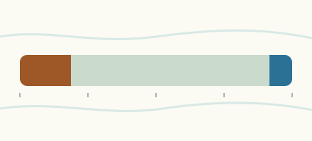
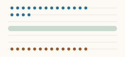
We follow 99 water level gauges in Northwest Territories. 10 gauges read below their normal range for the date and 8 gauges above it.
How many gauges do we follow in Northwest Territories?
99 Water Survey of Canada level gauges of the 2,148 we follow in Canada, as of 26 October 2026.
How many waters in Northwest Territories have a level gauge?
78 waters with a level gauge, of the 1,635 waters we follow in Canada, as of 26 October 2026.
How many gauges read below normal for the date?
10 gauges below their normal range, of the 75 gauges with a current reading and a normal range for the date, as of 26 October 2026.
How many gauges read above normal for the date?
8 gauges above their normal range, of the 75 gauges with a current reading and a normal range for the date, as of 26 October 2026.
How the places stand today
10 places below normal and 8 places above
Which places are furthest below normal?
Highway No. 7Blackstone River (Northwest Territories)
3.322 m
lower than any day of these dates in 22 years
More places
Which places are furthest above normal?
Ellice IslandMackenzie River (Reindeer Channel)
10.098 m
higher than any day of these dates in 32 years
Shallow Bay (upstream)Mackenzie River (Napoiak Channel)
11.171 m
in the highest 5 percent for the date
More places
Which gauges do we follow in Northwest Territories?
| Place | Reading | Against normal for the date | Change in a day |
|---|---|---|---|
| Anderson River | |||
| Carnwath River (downstream) | 1.869 m | in the lowest 5 percent for the date | +0.078 m |
| Lac Maunoir | 8.37 m | +0.057 m | |
| Arctic Red River | |||
| Mouth | 2.662 m | in the highest 10 percent for the date | +0.194 m |
| Baker Creek (Northwest Territories) | |||
| Outlet of Lower Martin Lake | 28.945 m | within the normal range for the date | 0 m |
| Barnston River | |||
| Mouth | 7.466 m | within the normal range for the date | -0.001 m |
| Beaulieu River | |||
| Great Slave Lake | 2.86 m | within the normal range for the date | -0.001 m |
| Big Lake | |||
| Taglu Island | 8.827 m | within the normal range for the date | +0.006 m |
| Big River | |||
| Egg River (upstream) | 1.876 m | -0.068 m | |
| Birch River (Northwest Territories) | |||
| Highway No. 7 | 0.57 m | lower than any day of these dates in 23 years | +0.054 m |
| Blackstone River (Northwest Territories) | |||
| Highway No. 7 | 3.322 m | lower than any day of these dates in 22 years | -0.10 m |
| Bluefish Lake | |||
| Yellowknife | 185.77 m | within the normal range for the date | +0.013 m |
| Bosworth Creek | |||
| Norman Wells | 9.109 m | within the normal range for the date | -0.032 m |
| Buffalo River | |||
| Highway No. 5 | 2.071 m | +0.132 m | |
| Cameron River (Northwest Territories) | |||
| Reid Lake (downstream) | 1.84 m | within the normal range for the date | +0.001 m |
| Camsell River | |||
| Lac Ste. Croix (upstream) | 8.848 m | -0.009 m | |
| Outlet of Clut Lake | 2.754 m | within the normal range for the date | -0.004 m |
| Canyon Creek | |||
| Pipeline Crossing | 6.807 m | -0.009 m | |
| Carcajou River | |||
| Imperial River (downstream) | 4.831 m | in the highest 10 percent for the date | -0.01 m |
| Caribou Creek (Northwest Territories) | |||
| Highway No. 8 (Dempster Highway) (upstream) | 5.982 m | within the normal range for the date | +0.055 m |
| Chick Creek | |||
| Chick Lake (upstream) | 8.547 m | within the normal range for the date | -0.002 m |
| Coppermine River | |||
| Desteffany Lake (downstream) | 6.247 m | within the normal range for the date | -0.006 m |
| Dubawnt River | |||
| Dubawnt Lake (upstream) | 9.941 m | +0.027 m | |
| Duncan Lake | |||
| Yellowknife | 212.10 m | within the normal range for the date | -0.009 m |
| Flat River | |||
| Mouth | 0.667 m | in the lowest 10 percent for the date | -0.123 m |
| Frank Channel | |||
| Great Slave Lake (upstream) | 98.843 m | +0.054 m | |
| Grainger River | |||
| Canadian Zinc Road | 8.173 m | +0.004 m | |
| Great Bear Lake | |||
| Hornby Bay | 6.162 m | in the lowest 10 percent for the date | +0.03 m |
| Great Bear River | |||
| Outlet of Great Bear Lake | 1.65 m | in the lowest 5 percent for the date | -0.034 m |
| Great Slave Lake | |||
| Hay River | 156.531 m | within the normal range for the date | -0.079 m |
| Outlet of Barnston River | 97.179 m | +0.025 m | |
| Yellowknife Bay | 156.602 m | within the normal range for the date | +0.06 m |
| Hanbury River | |||
| Hoare Lake (upstream) | 4.81 m | within the normal range for the date | +0.147 m |
| Hans Creek | |||
| Husky Lakes (upstream) | 3.865 m | within the normal range for the date | -0.021 m |
| Hare Indian River | |||
| Fort Good Hope | 3.78 m | within the normal range for the date | +0.109 m |
| Hay River | |||
| Alta/Nwt Boundary | 284.647 m | within the normal range for the date | -0.017 m |
| Hay River | 1.984 m | within the normal range for the date | -0.027 m |
| Hoarfrost River | |||
| Mouth | 7.818 m | within the normal range for the date | -0.025 m |
| Hornaday River | |||
| Park Boundary | 2.974 m | higher than any day of these dates in 14 years | +0.022 m |
| Indin River | |||
| Chalco Lake (upstream) | 1.563 m | within the normal range for the date | +0.001 m |
| Jean-Marie River | |||
| Highway No. 1 | 1.635 m | lower than any day of these dates in 21 years | 0 m |
| Johnny Hoe River | |||
| Lac Ste. Therese (upstream) | 3.286 m | +0.018 m | |
| Jungle Ridge Creek | |||
| Mouth | 7.843 m | within the normal range for the date | -0.002 m |
| Kakisa River | |||
| Outlet of Kakisa Lake | 2.477 m | within the normal range for the date | +0.009 m |
| Keele River | |||
| Twitya River (upstream) | 2.755 m | within the normal range for the date | +0.016 m |
| La Martre River | |||
| Outlet of Lac La Martre (downstream) | 3.738 m | within the normal range for the date | -0.04 m |
| Liard River | |||
| Fort Liard | 11.965 m | ||
| Mouth | 1.935 m | within the normal range for the date | -0.04 m |
| Lockhart River | |||
| Outlet of Artillery Lake | 1.831 m | within the normal range for the date | -0.027 m |
| Loon River (Northwest Territories) | |||
| Arctic Circle | 7.243 m | within the normal range for the date | +0.004 m |
| Mackenzie River | |||
| Arctic Red River | 3.409 m | within the normal range for the date | -0.02 m |
| Confluence East Channel | 2.487 m | within the normal range for the date | -0.021 m |
| Fort Good Hope | 1.049 m | within the normal range for the date | -0.056 m |
| Fort Providence | 150.86 m | within the normal range for the date | -0.067 m |
| Fort Simpson | 4.69 m | within the normal range for the date | +0.021 m |
| Jean Marie River | 94.604 m | +0.022 m | |
| Kuluarpak Channel | 9.246 m | in the highest 5 percent for the date | +0.068 m |
| Norman Wells | 4.052 m | within the normal range for the date | -0.008 m |
| Sans Sault Rapids | 3.655 m | within the normal range for the date | -0.007 m |
| Strong Point | 7.257 m | within the normal range for the date | +0.021 m |
| Mackenzie River (East Channel) | |||
| Inuvik | 11.636 m | within the normal range for the date | -0.007 m |
| Mackenzie River (Middle Channel) | |||
| Raymond Channel (downstream) | 11.287 m | within the normal range for the date | +0.001 m |
| Tununuk Point | 10.32 m | in the highest 5 percent for the date | +0.043 m |
| Mackenzie River (Napoiak Channel) | |||
| Shallow Bay (upstream) | 11.171 m | in the highest 5 percent for the date | -0.023 m |
| Mackenzie River (Peel Channel) | |||
| Aklavik (upstream) | 10.782 m | within the normal range for the date | -0.048 m |
| Mackenzie River (Reindeer Channel) | |||
| Ellice Island | 10.098 m | higher than any day of these dates in 32 years | +0.057 m |
| Mountain River | |||
| Cambrian Creek (downstream) | 5.207 m | -0.03 m | |
| Nonacho Lake | |||
| Lutselk'e (Snowdrift) | 6.358 m | within the normal range for the date | -0.003 m |
| Oscar Creek | |||
| Norman Wells | 7.895 m | +0.016 m | |
| Peel River | |||
| Fort McPherson (upstream) | 5.612 m | within the normal range for the date | -0.005 m |
| Frog Creek | 2.556 m | within the normal range for the date | -0.006 m |
| Point Lake | |||
| Outlet | 7.642 m | within the normal range for the date | -0.008 m |
| Prairie Creek (Northwest Territories) | |||
| Cadillac Mine - Site Two | 1.449 m | within the normal range for the date | +0.002 m |
| Prelude Lake | |||
| Yellowknife | 169.031 m | within the normal range for the date | -0.003 m |
| Prosperous Lake | |||
| McMeekan Bay | 158.119 m | within the normal range for the date | +0.007 m |
| Rat River (Northwest Territories) | |||
| Fort McPherson | 3.405 m | +0.098 m | |
| Redstone River | |||
| Mouth (63 km upstream) | 2.134 m | -0.04 m | |
| Rengleng River | |||
| Highway No. 8 (Dempster Highway) (downstream) | 5.602 m | within the normal range for the date | -0.066 m |
| Root River | |||
| Mouth | 3.136 m | within the normal range for the date | 0 m |
| Scotty Creek | |||
| Highway No. 7 | 2.912 m | in the lowest 10 percent for the date | +0.01 m |
| Snare River | |||
| Ghost River (downstream) | 26.251 m | in the lowest 10 percent for the date | -0.004 m |
| Indin Lake (upstream) | 6.438 m | within the normal range for the date | +0.012 m |
| South Nahanni River | |||
| Liard River Confluence | 91.186 m | -0.105 m | |
| Virginia Falls (upstream) | 1.911 m | within the normal range for the date | -0.196 m |
| Taltson River | |||
| Hydro Dam (downstream) | 98.256 m | within the normal range for the date | +0.001 m |
| Tazin River | |||
| Mouth | 9.957 m | within the normal range for the date | -0.004 m |
| Tatse Lake (upstream) | 8.796 m | +0.062 m | |
| Tetcela River | |||
| Canadian Zinc Road | 7.562 m | +0.003 m | |
| Thunder River | |||
| Mouth | 7.764 m | +0.066 m | |
| Tieda River | |||
| Mouth | 7.135 m | -0.275 m | |
| Trail Valley Creek | |||
| Inuvik | 29.119 m | 0 m | |
| Travaillant River | |||
| Travaillant Lake (upstream) | 8.421 m | in the highest 5 percent for the date | +0.026 m |
| Trout River (Northwest Territories) | |||
| Highway No. 1 | 1.064 m | within the normal range for the date | -0.019 m |
| Waldron River | |||
| Mouth | 2.094 m | within the normal range for the date | +0.001 m |
| Whitefish River (Northwest Territories) | |||
| Mouth | 3.868 m | -0.024 m | |
| Willowlake River | |||
| Metahdali Creek (upstream) | 3.538 m | lower than any day of these dates in 17 years | +0.048 m |
| Yamba River | |||
| Daring Lake (downstream) | 3.919 m | within the normal range for the date | -0.004 m |
| Yates River | |||
| Alberta Boundary | 6.664 m | -0.013 m | |
| Yellowknife River | |||
| Inlet to Prosperous Lake | 152.766 m | within the normal range for the date | -0.002 m |
| Quyta Lake (upstream) | 8.76 m | within the normal range for the date | -0.003 m |
Keep exploring
 Country, Canada Are the rivers and lakes in Canada unusually low or high? Every river and lake we follow in Canada, against normal for the date.
 Today's list, Canada Which places in Canada are furthest from normal today? The places in Canada furthest below and above normal today.
 River gauge, Canada Is the Willowlake River unusually low at Metahdali Creek (upstream)? Level now, history, the same date in past years and each year's range.
 River gauge, Canada Is the Birch River (Northwest Territories) unusually low at Highway No. 7? Level now, history, the same date in past years and each year's range.
Sources
- Data Source: Environment and Climate Change Canada (Water Survey of Canada) (source). Licence: ECCC Data Services End-use Licence v2.1.1