Newfoundland and Labrador river levels today
Are the rivers and lakes in Newfoundland and Labrador unusually low or high?
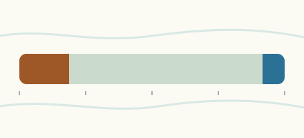
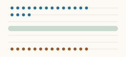
We follow 98 water level gauges in Newfoundland and Labrador. 8 gauges read below their normal range for the date and 3 gauges above it.
How many gauges do we follow in Newfoundland and Labrador?
98 Water Survey of Canada level gauges of the 2,148 we follow in Canada, as of 26 October 2026.
How many waters in Newfoundland and Labrador have a level gauge?
81 waters with a level gauge, of the 1,635 waters we follow in Canada, as of 26 October 2026.
How many gauges read below normal for the date?
8 gauges below their normal range, of the 88 gauges with a current reading and a normal range for the date, as of 26 October 2026.
How many gauges read above normal for the date?
3 gauges above their normal range, of the 88 gauges with a current reading and a normal range for the date, as of 26 October 2026.
How the places stand today
8 places below normal and 3 places above
Which places are furthest below normal?
Lower Muskrat Falls (6.15 km downstream)Churchill River (Labrador)
2.166 m
in the lowest 5 percent for the date
More places
Which places are furthest above normal?
Grand Lake Brook (east)Grand Lake (Newfoundland and Labrador)
86.898 m
in the highest 10 percent for the date
Which gauges do we follow in Newfoundland and Labrador?
| Place | Reading | Against normal for the date | Change in a day |
|---|---|---|---|
| Alexis River | |||
| Port Hope Simpson | 0.504 m | in the lowest 5 percent for the date | -0.04 m |
| Badger Brook | |||
| Foot Bridge (downstream) | 96.835 m | -0.026 m | |
| Bartletts River | |||
| St. Anthony | 1.514 m | in the lowest 10 percent for the date | -0.013 m |
| Bay Du Nord River | |||
| Big Falls | 1.314 m | within the normal range for the date | -0.009 m |
| Beothuk Lake | |||
| Indian Point | 153.853 m | within the normal range for the date | -0.01 m |
| Big Brook | |||
| Lead Cove | 3.198 m | within the normal range for the date | -0.013 m |
| Boot Brook | |||
| Trans-Canada Highway | 0.934 m | within the normal range for the date | -0.009 m |
| Camp Pond | |||
| Southwest End | 1.093 m | within the normal range for the date | -0.005 m |
| Camp Pond Brook | |||
| Camp Pond (downstream) | 1.347 m | within the normal range for the date | -0.008 m |
| Cat Arm Reservoir | |||
| Spillway | 391.777 m | within the normal range for the date | -0.023 m |
| Churchill River (Labrador) | |||
| Churchill Falls Tailrace (downstream) | 124.597 m | -0.071 m | |
| Churchill Falls Tailrace (upstream) | 138.401 m | within the normal range for the date | -0.004 m |
| End of Mud Lake Road | 0.064 m | -0.044 m | |
| English Point | 0.052 m | within the normal range for the date | -0.022 m |
| Grizzle Rapids (upstream) | 39.081 m | within the normal range for the date | -0.017 m |
| Happy Valley | 0.295 m | -0.014 m | |
| Lower Muskrat Falls (6.15 km downstream) | 2.166 m | in the lowest 5 percent for the date | +0.08 m |
| Metchin River (downstream) | 113.148 m | within the normal range for the date | +0.07 m |
| Traverspine River (downstream) | 0.341 m | +0.011 m | |
| Upper Muskrat Falls (upstream) | 38.992 m | within the normal range for the date | +0.025 m |
| Churchill River Outlet | |||
| Rabbit Island | -0.01 m | -0.04 m | |
| Come by Chance River | |||
| Goobies | 0.814 m | within the normal range for the date | -0.035 m |
| Conne River | |||
| Outlet of Conne River Pond | 1.951 m | within the normal range for the date | -0.011 m |
| Corner Brook Lake | |||
| Lake Outlet | 5.861 m | higher than any day of these dates in 36 years | -0.031 m |
| Deer Lake | |||
| Generating Station | 5.964 m | in the highest 5 percent for the date | -0.034 m |
| Dumbell Stream | |||
| Dumbell Lake (upstream) | 0.894 m | +0.001 m | |
| Eagle River (Newfoundland and Labrador) | |||
| Falls (upstream) | 1.463 m | in the lowest 10 percent for the date | -0.024 m |
| Exploits River | |||
| Badger | 95.886 m | within the normal range for the date | -0.185 m |
| Charlie Edwards Point | 70.37 m | within the normal range for the date | -0.251 m |
| Millertown | 2.144 m | within the normal range for the date | -0.25 m |
| Noel Pauls Brook (downstream) | 5.885 m | within the normal range for the date | -0.331 m |
| Flora Creek | |||
| Trans Labrador Highway (downstream) | 1.141 m | in the lowest 10 percent for the date | -0.011 m |
| Gander River | |||
| Big Chute | 1.882 m | within the normal range for the date | -0.012 m |
| Garnish River | |||
| Garnish | 1.059 m | within the normal range for the date | -0.011 m |
| Grand Lake (Newfoundland and Labrador) | |||
| Grand Lake Brook (east) | 86.898 m | in the highest 10 percent for the date | -0.039 m |
| Grandy Brook | |||
| Top Pond Brook (downstream) | 1.57 m | in the lowest 5 percent for the date | -0.012 m |
| Granite Lake | |||
| East End | 311.826 m | within the normal range for the date | +0.013 m |
| Great Rattling Brook | |||
| Tote River Confluence (upstream) | 3.437 m | within the normal range for the date | -0.021 m |
| Greavett Brook | |||
| Portland Creek Pond (upstream) | 0.712 m | within the normal range for the date | -0.001 m |
| Grey River | |||
| Grey River | 2.236 m | in the lowest 10 percent for the date | -0.035 m |
| Harrys River | |||
| Highway Bridge (downstream) | 1.33 m | within the normal range for the date | -0.016 m |
| Highlands River | |||
| Trans-Canada Highway | 0.832 m | within the normal range for the date | -0.004 m |
| Humber River (Newfoundland and Labrador) | |||
| Humber Village Bridge | 2.989 m | ||
| Indian Bay Brook | |||
| Northwest Arm | 4.794 m | within the normal range for the date | -0.011 m |
| Indian Brook Diversion | |||
| Birchy Lake (upstream) | 3.52 m | within the normal range for the date | -0.021 m |
| Isle Aux Morts River | |||
| Highway Bridge (downstream) | 1.637 m | in the lowest 10 percent for the date | -0.026 m |
| Learys Brook | |||
| Prince Philip Drive | 0.732 m | within the normal range for the date | -0.044 m |
| Lewaseechjeech Brook | |||
| Little Grand Lake | 1.072 m | within the normal range for the date | -0.044 m |
| Little Salmonier River | |||
| North Harbour | 2.477 m | within the normal range for the date | -0.109 m |
| Lloyds River | |||
| King George IV Lake (downstream) | 1.275 m | within the normal range for the date | -0.03 m |
| Mahers River | |||
| Holyrood | 1.525 m | within the normal range for the date | -0.129 m |
| Main River | |||
| Paradise Pool | 0.926 m | within the normal range for the date | -0.053 m |
| Middle Brook | |||
| Gambo | 2.879 m | within the normal range for the date | -0.013 m |
| Mud Lake Outlet Tributary | |||
| Mud Lake | -0.056 m | -0.014 m | |
| Northeast Brook | |||
| Roddickton | 0.373 m | within the normal range for the date | -0.017 m |
| Northeast Pond River | |||
| Northeast Pond | 0.362 m | within the normal range for the date | -0.074 m |
| Northeast River | |||
| Placentia | 1.428 m | within the normal range for the date | -0.034 m |
| Northwest River | |||
| Terra Nova National Park | 0.988 m | within the normal range for the date | -0.034 m |
| Peters River | |||
| Botwood | 1.018 m | within the normal range for the date | -0.008 m |
| Pinus River | |||
| Pinus River | 1.679 m | within the normal range for the date | -0.007 m |
| Pipers Hole River | |||
| Mothers Brook | 0.655 m | within the normal range for the date | -0.022 m |
| Pumphouse Stream | |||
| Drum Lake (upstream) | 750.901 m | ||
| R.r. Pond | |||
| Granite Lake | 274.292 m | within the normal range for the date | +0.003 m |
| Rattle Brook | |||
| Boat Harbour | 1.401 m | within the normal range for the date | -0.013 m |
| Rattler Brook | |||
| McIvers | 0.254 m | within the normal range for the date | -0.004 m |
| Rattling Brook | |||
| Big Pond | 108.195 m | within the normal range for the date | -0.001 m |
| Bridge (downstream) | 83.332 m | within the normal range for the date | -0.011 m |
| Plant Discharge (downstream) | 72.571 m | within the normal range for the date | -0.012 m |
| Reid Brook | |||
| Outlet of Reid Pond | 1.648 m | within the normal range for the date | +0.039 m |
| Tributary (downstream) | 1.447 m | within the normal range for the date | +0.008 m |
| Rocky River | |||
| Colinet | 0.899 m | within the normal range for the date | -0.062 m |
| Salmon Cove River | |||
| Champneys | 1.312 m | within the normal range for the date | -0.02 m |
| Salmon River (Newfoundland and Labrador) | |||
| Glenwood | 0.727 m | within the normal range for the date | -0.01 m |
| Salmonier River | |||
| Lamaline | 1.122 m | within the normal range for the date | -0.048 m |
| Seal Cove Brook | |||
| Cappahayden | 2.30 m | within the normal range for the date | -0.12 m |
| Shearstown Brook | |||
| Shearstown | 0.237 m | within the normal range for the date | -0.043 m |
| Sheffield Brook | |||
| Trans Canada Highway | 1.98 m | within the normal range for the date | -0.015 m |
| Shoal Harbour River | |||
| Clarenville | 1.965 m | within the normal range for the date | +0.002 m |
| South Brook | |||
| Pasadena | 0.295 m | within the normal range for the date | -0.004 m |
| South West Brook | |||
| Baie Verte | 1.135 m | within the normal range for the date | -0.01 m |
| Southern Bay River | |||
| Southern Bay | 2.223 m | within the normal range for the date | -0.008 m |
| Southwest Brook (Lewisporte) | |||
| Lewisporte | 0.79 m | within the normal range for the date | -0.012 m |
| Southwest Brook (Terra Nova National Park) | |||
| Terra Nova National Park | 1.554 m | within the normal range for the date | -0.005 m |
| St. Shotts River | |||
| Trepassey | 0.638 m | within the normal range for the date | -0.032 m |
| Star Brook | |||
| Star Lake (upstream) | 1.36 m | within the normal range for the date | -0.019 m |
| Steady Brook | |||
| Confluence to Humber River (upstream) | 1.933 m | within the normal range for the date | -0.041 m |
| Terra Nova River | |||
| Glovertown | 5.455 m | within the normal range for the date | +0.008 m |
| Torrent River | |||
| Bristol's Pool | 1.131 m | within the normal range for the date | -0.035 m |
| Triton Brook | |||
| Gambo Pond (upstream) | 1.03 m | within the normal range for the date | -0.02 m |
| Ugjoktok River | |||
| Harp Lake (downstream) | 1.197 m | within the normal range for the date | +0.003 m |
| Upper Humber River | |||
| Black Brook (upstream) | 0.789 m | within the normal range for the date | -0.034 m |
| Reidville | 0.883 m | within the normal range for the date | -0.05 m |
| Victoria Lake | |||
| Northeast Control Structure | 322.44 m | within the normal range for the date | -0.035 m |
| Virginia River | |||
| Pleasantville | 1.329 m | within the normal range for the date | -0.029 m |
| Wabush Lake | |||
| Dolomite Road | 1.394 m | within the normal range for the date | -0.014 m |
| Lake Outlet | 2.782 m | within the normal range for the date | -0.02 m |
| Waterford River | |||
| Kilbride | 0.539 m | within the normal range for the date | -0.053 m |
| White Bear River | |||
| Big Indian Brook (upstream) | 1.698 m | within the normal range for the date | -0.023 m |
Keep exploring
 Country, Canada Are the rivers and lakes in Canada unusually low or high? Every river and lake we follow in Canada, against normal for the date.
 Today's list, Canada Which places in Canada are furthest from normal today? The places in Canada furthest below and above normal today.
 River gauge, Canada Is the Churchill River (Labrador) unusually low at Lower Muskrat Falls (6.15 km downstream)? Level now, history, the same date in past years and each year's range.
 River gauge, Canada Is the Alexis River unusually low at Port Hope Simpson? Level now, history, the same date in past years and each year's range.
Sources
- Data Source: Environment and Climate Change Canada (Water Survey of Canada) (source). Licence: ECCC Data Services End-use Licence v2.1.1