New Brunswick river levels today
Are the rivers and lakes in New Brunswick unusually low or high?
We follow 50 water level gauges in New Brunswick. 39 gauges read below their normal range for the date and none above it.
How many gauges do we follow in New Brunswick?
50 Water Survey of Canada level gauges of the 2,151 we follow in Canada, as of 21 November 2026.
How many waters in New Brunswick have a level gauge?
41 waters with a level gauge, of the 1,634 waters we follow in Canada, as of 21 November 2026.
How many gauges read below normal for the date?
39 gauges below their normal range, of the 48 gauges with a current reading and a normal range for the date, as of 21 November 2026.
How many gauges read above normal for the date?
0 gauges above their normal range, of the 48 gauges with a current reading and a normal range for the date, as of 21 November 2026.
How the places stand today
39 places below normal and 0 places above
Which places are furthest below normal?
More places
Which gauges do we follow in New Brunswick?
| Place | Reading | Against normal for the date | Change in a day |
|---|---|---|---|
| Aroostook River | |||
| Tinker | 2.391 m | lower than any day of these dates in 14 years | -1.013 m |
| Becaguimec Stream | |||
| Coldstream | 0.268 m | in the lowest 5 percent for the date | -0.005 m |
| Big Presque Isle Stream | |||
| Tracey Mills | 0.238 m | in the lowest 5 percent for the date | -0.006 m |
| Black River (New Brunswick) | |||
| Garnet Settlement | 1.211 m | in the lowest 5 percent for the date | -0.01 m |
| Canaan River | |||
| East Canaan | 0.437 m | in the lowest 10 percent for the date | -0.013 m |
| Catamaran Brook | |||
| Repap Road Bridge | 0.473 m | in the lowest 5 percent for the date | -0.002 m |
| Coal Branch River | |||
| Beersville | 0.939 m | within the normal range for the date | -0.012 m |
| Dennis Stream | |||
| St. Stephen | 1.456 m | in the lowest 5 percent for the date | -0.006 m |
| Eel River | |||
| Dundee | 0.943 m | in the lowest 5 percent for the date | -0.007 m |
| French Lake | |||
| Lakeville Corner | 1.071 m | in the lowest 5 percent for the date | -0.028 m |
| Grand Falls Flowage | |||
| Grand Falls | 61.449 m | in the lowest 10 percent for the date | -0.003 m |
| Grand Lake (New Brunswick) | |||
| Newcastle Creek | 1.032 m | in the lowest 5 percent for the date | -0.028 m |
| Grande Riviere (New Brunswick) | |||
| Violette Bridge | 0.575 m | ||
| Iroquois River | |||
| Moulin Morneault | 3.43 m | lower than any day of these dates in 15 years | -0.012 m |
| Jacquet River | |||
| Durham Centre | 1.119 m | in the lowest 10 percent for the date | -0.012 m |
| Jemseg River | |||
| Jemseg | 1.036 m | in the lowest 5 percent for the date | -0.012 m |
| Kennebecasis River | |||
| Apohaqui | 7.486 m | in the lowest 10 percent for the date | -0.016 m |
| Lepreau River | |||
| Lepreau | 0.356 m | in the lowest 10 percent for the date | -0.011 m |
| Little Southwest Miramichi River | |||
| Lyttleton | 1.206 m | in the lowest 5 percent for the date | -0.004 m |
| Magaguadavic Lake | |||
| Upper Magaguadavic | 115.96 m | within the normal range for the date | +0.002 m |
| Magaguadavic River | |||
| Elmcroft | 0.811 m | in the lowest 10 percent for the date | -0.011 m |
| Meduxnekeag River | |||
| Belleville | 0.73 m | in the lowest 5 percent for the date | -0.009 m |
| Middle Branch Nashwaaksis Stream | |||
| Sandwith's Farm | 0.197 m | in the lowest 5 percent for the date | -0.012 m |
| Middle River (New Brunswick) | |||
| Bathurst | 0.799 m | in the lowest 10 percent for the date | -0.011 m |
| Nackawic Stream | |||
| Temperance Vale | 0.605 m | lower than any day of these dates in 14 years | -0.008 m |
| Narrows Mountain Brook | |||
| Narrows Mountain | 5.143 m | in the lowest 5 percent for the date | 0 m |
| Nashwaak River | |||
| Durham Bridge | 17.831 m | in the lowest 10 percent for the date | -0.008 m |
| North Branch Oromocto River | |||
| Tracy | 0.457 m | in the lowest 5 percent for the date | -0.007 m |
| Northwest Miramichi River | |||
| Trout Brook | 0.636 m | within the normal range for the date | -0.015 m |
| Petitcodiac River | |||
| Petitcodiac | 0.372 m | in the lowest 5 percent for the date | -0.007 m |
| Point Wolfe River | |||
| Fundy National Park | 0.403 m | in the lowest 5 percent for the date | -0.01 m |
| Restigouche River | |||
| Kedgwick River (downstream) | 0.774 m | lower than any day of these dates in 15 years | -0.008 m |
| Rafting Ground Brook (upstream) | 0.79 m | in the lowest 5 percent for the date | -0.004 m |
| Riviere Caraquet | |||
| Burnsville | 0.341 m | within the normal range for the date | -0.001 m |
| Saint John River | |||
| Edmundston | 134.465 m | lower than any day of these dates in 40 years | -0.09 m |
| Fredericton | 1.155 m | in the lowest 10 percent for the date | +0.018 m |
| Gagetown | 1.103 m | lower than any day of these dates in 31 years | +0.002 m |
| Grand Falls | 89.123 m | lower than any day of these dates in 14 years | -0.171 m |
| Maugerville | 1.131 m | in the lowest 10 percent for the date | +0.002 m |
| Oak Point | 0.805 m | within the normal range for the date | -0.041 m |
| Saint John | 0.902 m | in the lowest 5 percent for the date | -0.035 m |
| Upper Gagetown | 1.16 m | in the lowest 5 percent for the date | 0 m |
| Salmon River (New Brunswick) | |||
| Castaway | 10.25 m | within the normal range for the date | -0.017 m |
| Shogomoc Stream | |||
| Trans Canada Highway | 0.453 m | in the lowest 5 percent for the date | -0.008 m |
| Southwest Miramichi River | |||
| Blackville | 0.583 m | in the lowest 5 percent for the date | -0.012 m |
| Spednic Lake | |||
| St. Croix | 114.913 m | in the lowest 10 percent for the date | 0 m |
| St. Francis River | |||
| Outlet of Glasier Lake | 0.935 m | within the normal range for the date | -0.012 m |
| Tobique River | |||
| Plaster Rock | 97.121 m | -0.007 m | |
| Riley Brook | 1.442 m | within the normal range for the date | -0.007 m |
| Upsalquitch River | |||
| Upsalquitch | 0.865 m | within the normal range for the date | -0.002 m |
Keep exploring
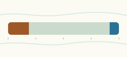 Country, Canada Are the rivers and lakes in Canada unusually low or high? Every river and lake we follow in Canada, against normal for the date.
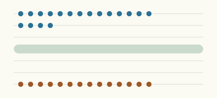 Today's list, Canada Which places in Canada are furthest from normal today? The places in Canada furthest below and above normal today.
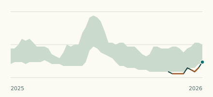 River gauge, Canada Is the Aroostook River unusually low at Tinker? Level now, history, the same date in past years and each year's range.
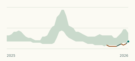 River gauge, Canada Is the Saint John River unusually low at Grand Falls? Level now, history, the same date in past years and each year's range.
Sources
- Data Source: Environment and Climate Change Canada (Water Survey of Canada) (source). Licence: ECCC Data Services End-use Licence v2.1.1