Manitoba river levels today
Are the rivers and lakes in Manitoba unusually low or high?
We follow 244 water level gauges in Manitoba. 5 gauges read below their normal range for the date and 33 gauges above it.
How many gauges do we follow in Manitoba?
244 Water Survey of Canada level gauges of the 2,148 we follow in Canada, as of 26 October 2026.
How many waters in Manitoba have a level gauge?
177 waters with a level gauge, of the 1,635 waters we follow in Canada, as of 26 October 2026.
How many gauges read below normal for the date?
5 gauges below their normal range, of the 215 gauges with a current reading and a normal range for the date, as of 26 October 2026.
How many gauges read above normal for the date?
33 gauges above their normal range, of the 215 gauges with a current reading and a normal range for the date, as of 26 October 2026.
How the places stand today
5 places below normal and 33 places above
Which places are furthest below normal?
Which places are furthest above normal?
More places
Which gauges do we follow in Manitoba?
| Place | Reading | Against normal for the date | Change in a day |
|---|---|---|---|
| Angling River | |||
| Bird | 13.066 m | within the normal range for the date | -0.035 m |
| Antler River | |||
| Melita | 1.578 m | within the normal range for the date | -0.006 m |
| Arrow River | |||
| Arrow River | 101.072 m | higher than any day of these dates in 14 years | +0.015 m |
| Assiniboine River | |||
| Baie St. Paul | 240.139 m | within the normal range for the date | -0.001 m |
| Brandon | 356.646 m | within the normal range for the date | +0.01 m |
| Griswold (north) | 362.292 m | within the normal range for the date | -0.003 m |
| Headingley | 231.807 m | within the normal range for the date | -0.004 m |
| Holland | 293.756 m | within the normal range for the date | -0.004 m |
| Miniota | 374.687 m | within the normal range for the date | -0.019 m |
| Portage La Prairie | 255.168 m | within the normal range for the date | +0.003 m |
| Russell | 408.764 m | in the highest 10 percent for the date | -0.002 m |
| Shellmouth Bridge | 411.90 m | ||
| St. Lazare (southwest) | 389.253 m | within the normal range for the date | +0.001 m |
| Virden (east) | 367.87 m | in the highest 10 percent for the date | -0.036 m |
| Athapapuskow Lake | |||
| Cranberry Portage | 291.87 m | within the normal range for the date | -0.018 m |
| Back Lake | |||
| Oxford House | 187.211 m | within the normal range for the date | -0.091 m |
| Badger Creek | |||
| Cartwright | 93.654 m | within the normal range for the date | -0.003 m |
| Baileys Creek | |||
| Oak Lake | 102.894 m | within the normal range for the date | -0.004 m |
| Big Grass River | |||
| Glenella | 1.306 m | within the normal range for the date | -0.016 m |
| Birch River (Birch River) | |||
| Birch River | 296.046 m | within the normal range for the date | 0 m |
| Birch River (Prawda) | |||
| Prawda | 97.945 m | within the normal range for the date | +0.04 m |
| Bird River | |||
| Outlet of Bird Lake | 1.073 m | within the normal range for the date | +0.01 m |
| Birdtail Creek | |||
| Birtle | 484.284 m | within the normal range for the date | 0 m |
| Blackbird Creek | |||
| Shellmouth | 94.232 m | -0.001 m | |
| Bloodvein River | |||
| Bloodvein Bay (upstream) | 29.471 m | within the normal range for the date | -0.011 m |
| Boissevain Reservoir | |||
| Boissevain | 517.673 m | higher than any day of these dates in 31 years | +0.001 m |
| Bone Lake Outlet | |||
| Ninette | 7.421 m | within the normal range for the date | -0.006 m |
| Boyne River (Manitoba) | |||
| Carman | 252.108 m | within the normal range for the date | +0.001 m |
| Carman Dam (upstream) | 262.807 m | within the normal range for the date | +0.006 m |
| Roseisle | 0.949 m | within the normal range for the date | +0.009 m |
| Brokenhead River | |||
| Beausejour | 228.442 m | within the normal range for the date | +0.029 m |
| Buffalo Creek (Manitoba) | |||
| Rosenfeld | 234.794 m | within the normal range for the date | -0.013 m |
| Burnt Lake Drain | |||
| Lundar (northwest) | 6.955 m | within the normal range for the date | -0.008 m |
| Burntwood River | |||
| Leaf Rapids (upstream) | 99.465 m | in the highest 10 percent for the date | +0.253 m |
| Manasan Falls (upstream) | 197.215 m | within the normal range for the date | +0.021 m |
| Thompson | 187.48 m | within the normal range for the date | +0.029 m |
| Burrows Reservoir | |||
| Merridale | 624.51 m | ||
| Caddy Lake | |||
| Caddy Lake (Campground) | 318.298 m | within the normal range for the date | +0.003 m |
| Carrot River | |||
| The Pas | 257.179 m | within the normal range for the date | -0.004 m |
| Churchill River (Saskatchewan and Manitoba) | |||
| Fidler Lake (downstream) | 23.916 m | within the normal range for the date | +0.224 m |
| Granville Falls (upstream) | 243.887 m | within the normal range for the date | +0.028 m |
| Leaf Rapids (upstream) | 259.546 m | within the normal range for the date | +0.02 m |
| Red Head Rapids (upstream) | 23.236 m | within the normal range for the date | +0.166 m |
| Cochrane River | |||
| Brochet | 29.265 m | within the normal range for the date | +0.008 m |
| Conjuring Creek | |||
| Russell | 553.607 m | in the highest 10 percent for the date | +0.01 m |
| Cormorant Lake | |||
| Cormorant | 256.262 m | within the normal range for the date | -0.015 m |
| Cypress Creek | |||
| Clearwater | 449.588 m | within the normal range for the date | -0.006 m |
| Cypress River | |||
| Bruxelles | 100.205 m | within the normal range for the date | -0.002 m |
| Dauphin Lake | |||
| Ochre Beach | 261.096 m | in the highest 5 percent for the date | +0.023 m |
| Outlet | 261.06 m | in the highest 5 percent for the date | -0.029 m |
| Deadhorse Creek | |||
| Morden | 96.799 m | 0 m | |
| Rosenfeld | 1.287 m | within the normal range for the date | -0.002 m |
| Deer River | |||
| Belcher (north) | 31.456 m | within the normal range for the date | +0.221 m |
| Deerhorn Creek | |||
| Welby | 96.885 m | -0.002 m | |
| Deloraine Reservoir | |||
| Deloraine | 540.077 m | within the normal range for the date | -0.001 m |
| Devils Creek | |||
| Libau | 1.773 m | within the normal range for the date | 0 m |
| Eager Lake | |||
| Tod Lake | 33.765 m | within the normal range for the date | -0.003 m |
| East Fisher River | |||
| Hodgson | 225.151 m | in the lowest 10 percent for the date | -0.004 m |
| Elgin Creek | |||
| Souris | 0.922 m | in the highest 10 percent for the date | -0.015 m |
| Elgin Reservoir | |||
| Elgin | 466.957 m | within the normal range for the date | -0.001 m |
| Elm Creek Channel | |||
| Elm Creek | 99.886 m | within the normal range for the date | -0.007 m |
| Epinette Creek | |||
| Carberry | 0.951 m | within the normal range for the date | -0.004 m |
| Fairford River | |||
| Fairford | 246.101 m | within the normal range for the date | -0.086 m |
| Falcon Lake | |||
| Falcon Lake | 324.794 m | within the normal range for the date | -0.001 m |
| Family Lake | |||
| Little Grand Rapids | 304.372 m | within the normal range for the date | -0.018 m |
| Fisher River | |||
| Dallas (north) | 219.895 m | +0.005 m | |
| Fisherton | 6.164 m | within the normal range for the date | -0.004 m |
| Footprint Lake | |||
| Nelson House | 243.168 m | within the normal range for the date | +0.046 m |
| Footprint River | |||
| Footprint Lake (upstream) | 29.69 m | within the normal range for the date | +0.01 m |
| Gainsborough Creek | |||
| Lyleton | 0.643 m | within the normal range for the date | -0.009 m |
| Garland River | |||
| Garland | 7.703 m | within the normal range for the date | -0.003 m |
| Gauer River | |||
| Thorsteinson Lake (downstream) | 29.434 m | within the normal range for the date | +0.086 m |
| Gods River | |||
| Shamattawa | 25.474 m | within the normal range for the date | +0.025 m |
| Gopher Creek | |||
| Virden | 0.759 m | within the normal range for the date | -0.001 m |
| Goudney Reservoir | |||
| Pilot Mound | 451.39 m | ||
| Graham Creek (Manitoba) | |||
| Melita | 429.114 m | -0.006 m | |
| Granville Lake | |||
| Granville Lake | 260.20 m | ||
| Grass River | |||
| Standing Stone Falls (upstream) | 29.442 m | within the normal range for the date | +0.003 m |
| Grassmere Creek Drain | |||
| Middlechurch | 227.389 m | within the normal range for the date | -0.01 m |
| Icelandic River | |||
| Riverton | 219.032 m | within the normal range for the date | -0.01 m |
| Jackson Lake | |||
| Sidney | 357.649 m | within the normal range for the date | -0.001 m |
| Joubert Creek | |||
| Pansy | 5.196 m | within the normal range for the date | 0 m |
| St. Pierre-Jolys | 236.103 m | within the normal range for the date | +0.022 m |
| Kenton Reservoir | |||
| Kenton | 441.289 m | within the normal range for the date | -0.001 m |
| Kettle River (Manitoba) | |||
| Gillam | 4.783 m | within the normal range for the date | -0.065 m |
| Killarney Lake | |||
| Killarney | 492.357 m | in the highest 10 percent for the date | -0.003 m |
| Kronsgart Drain | |||
| Sewell | 1.668 m | -0.008 m | |
| La Salle River | |||
| Elie | 237.422 m | in the lowest 5 percent for the date | -0.006 m |
| La Salle | 228.037 m | within the normal range for the date | 0 m |
| Sanford | 231.09 m | within the normal range for the date | +0.042 m |
| Sanford Dam (upstream) | 232.801 m | within the normal range for the date | +0.008 m |
| Lake Irwin | |||
| Neepawa | 359.093 m | in the highest 10 percent for the date | -0.005 m |
| Lake Manitoba | |||
| Steep Rock | 247.628 m | within the normal range for the date | -0.071 m |
| Westbourne | 247.685 m | in the highest 10 percent for the date | +0.022 m |
| Lake Minnewasta | |||
| Morden | 329.033 m | within the normal range for the date | -0.01 m |
| Lake of the Prairies | |||
| Shellmouth | 428.375 m | in the highest 5 percent for the date | -0.024 m |
| Lake St. Martin | |||
| Hilbre | 243.695 m | within the normal range for the date | +0.046 m |
| Lake Wahtopanah | |||
| Rivers | 467.95 m | within the normal range for the date | +0.007 m |
| Lake Winnipeg | |||
| Berens River | 217.516 m | within the normal range for the date | -0.341 m |
| George Island | 217.464 m | within the normal range for the date | -0.026 m |
| Gimli | 217.746 m | within the normal range for the date | +0.055 m |
| Matheson Island Landing | 217.48 m | within the normal range for the date | -0.354 m |
| Mission Point | 217.454 m | within the normal range for the date | +0.25 m |
| Pine Dock | 217.574 m | within the normal range for the date | -0.28 m |
| Victoria Beach | 217.766 m | within the normal range for the date | -0.027 m |
| Lake Winnipegosis | |||
| Dawson Bay | 253.503 m | in the highest 10 percent for the date | +0.359 m |
| Winnipegosis | 253.809 m | in the highest 10 percent for the date | -0.243 m |
| Limestone River | |||
| Bird | 65.038 m | within the normal range for the date | +0.067 m |
| Little Beaver River | |||
| Mouth | 29.243 m | in the highest 5 percent for the date | +0.236 m |
| Little Churchill River | |||
| Recluse Lake (upstream) | 29.451 m | within the normal range for the date | +0.098 m |
| Little Morris River | |||
| Rosenort | 233.743 m | within the normal range for the date | -0.008 m |
| Little Saskatchewan River | |||
| Horod | 7.927 m | within the normal range for the date | -0.014 m |
| Minnedosa | 522.451 m | within the normal range for the date | -0.002 m |
| Rapid City Dam (upstream) | 479.592 m | within the normal range for the date | -0.029 m |
| Rivers | 451.351 m | within the normal range for the date | +0.002 m |
| Little Souris River | |||
| Brandon | 1.644 m | within the normal range for the date | -0.013 m |
| Long River | |||
| Holmfield | 468.39 m | within the normal range for the date | +0.001 m |
| Main Drain (Manitoba) | |||
| Dominion City | 235.19 m | within the normal range for the date | -0.005 m |
| Manigotagan River | |||
| Manigotagan | 223.468 m | within the normal range for the date | +0.005 m |
| Manning Canal | |||
| Ile Des Chenes | 0.794 m | in the lowest 5 percent for the date | -0.047 m |
| Marsh River | |||
| Otterburne | 231.99 m | within the normal range for the date | -0.003 m |
| Mary Jane Reservoir | |||
| La Riviere | 468.291 m | within the normal range for the date | -0.003 m |
| McKinnon Creek | |||
| McCreary | 2.174 m | within the normal range for the date | +0.004 m |
| Medora Creek | |||
| Napinka | 0.862 m | -0.023 m | |
| Mink Creek | |||
| Ethelbert | 337.532 m | within the normal range for the date | +0.001 m |
| Minnedosa Lake | |||
| Minnedosa | 512.262 m | -0.005 m | |
| Minnewasta Creek | |||
| Beulah | 97.582 m | -0.002 m | |
| Morris River | |||
| Rosenort | 232.694 m | within the normal range for the date | -0.034 m |
| Mossy River | |||
| Outlet of Dauphin Lake (downstream) | 260.898 m | in the highest 10 percent for the date | -0.012 m |
| Mowbray Creek | |||
| Mowbray | 466.178 m | within the normal range for the date | -0.005 m |
| Netley Creek | |||
| Petersfield | 226.683 m | within the normal range for the date | -0.016 m |
| Norquay Channel | |||
| Homewood | 6.625 m | within the normal range for the date | -0.025 m |
| North Duck River | |||
| Cowan | 356.49 m | within the normal range for the date | -0.007 m |
| North Moose Lake | |||
| Moose Lake Narrows Control Structure | 256.402 m | within the normal range for the date | -0.12 m |
| Nutimik Lake | |||
| Nutimik Lake | 274.189 m | within the normal range for the date | -0.106 m |
| Oak Creek | |||
| Stockton | 364.638 m | within the normal range for the date | -0.029 m |
| Oak Lake | |||
| Oak Lake Resort | 429.639 m | within the normal range for the date | -0.012 m |
| Oak River | |||
| Bradwardine | 92.581 m | +0.014 m | |
| Rivers | 0.776 m | within the normal range for the date | -0.015 m |
| Ochre River | |||
| Ochre River | 279.094 m | within the normal range for the date | -0.009 m |
| Odei River | |||
| Thompson | 96.898 m | within the normal range for the date | +0.057 m |
| Omands Creek | |||
| Empress Street East | 3.637 m | within the normal range for the date | -0.01 m |
| Overflowing River | |||
| Overflowing River | 254.03 m | within the normal range for the date | +0.004 m |
| Pansy Drain | |||
| Sarto | 0.475 m | within the normal range for the date | +0.171 m |
| Pelican Creek South Tributary | |||
| Birnie | 1.509 m | in the lowest 10 percent for the date | -0.002 m |
| Pelican Lake (Manitoba) | |||
| Ninette | 411.737 m | within the normal range for the date | -0.011 m |
| North Shore | 411.733 m | -0.002 m | |
| Pembina River (Manitoba) | |||
| Crystal Creek (downstream) | 1.153 m | within the normal range for the date | -0.018 m |
| Killarney (north) | 481.205 m | -0.007 m | |
| La Riviere | 392.826 m | in the highest 10 percent for the date | +0.004 m |
| Lorne Lake (upstream) | 411.486 m | +0.044 m | |
| Outlet of Swan Lake | 398.231 m | -0.042 m | |
| Windygates | 337.362 m | in the highest 10 percent for the date | +0.001 m |
| Pine Creek (Manitoba) | |||
| Melbourne | 353.943 m | within the normal range for the date | -0.012 m |
| Pipestone Creek (Saskatchewan and Manitoba) | |||
| Pipestone | 94.387 m | in the highest 10 percent for the date | +0.012 m |
| Saskatchewan Boundary | 0.905 m | within the normal range for the date | +0.02 m |
| Pleasant Valley Reservoir | |||
| Petlura | 540.296 m | in the highest 5 percent for the date | -0.014 m |
| Plum Creek | |||
| Souris | 417.61 m | higher than any day of these dates in 14 years | +0.006 m |
| Portage Diversion | |||
| Portage La Prairie | 259.971 m | 0 m | |
| Portage Reservoir | |||
| Portage La Prairie | 262.316 m | within the normal range for the date | 0 m |
| Pukatawagan Lake | |||
| Pukatawagan | 274.169 m | within the normal range for the date | +0.013 m |
| Rat Creek (Manitoba) | |||
| Macdonald | 7.11 m | within the normal range for the date | +0.023 m |
| Rat Lake | |||
| Notigi Control Structure | 258.132 m | in the highest 10 percent for the date | +0.01 m |
| Rat River (Manitoba) | |||
| Otterburne | 231.768 m | within the normal range for the date | -0.019 m |
| Sundown | 315.774 m | within the normal range for the date | -0.039 m |
| Red Deer River (Manitoba) | |||
| Mouth | 253.852 m | within the normal range for the date | -0.162 m |
| Red River | |||
| Breezy Point | 217.654 m | within the normal range for the date | +0.24 m |
| Emerson | 228.464 m | within the normal range for the date | -0.034 m |
| Floodway Control Structure (downstream) | 223.418 m | -0.004 m | |
| Floodway Control Structure (upstream) | 223.225 m | within the normal range for the date | +0.003 m |
| James Avenue Pumping Station | 222.669 m | within the normal range for the date | +0.012 m |
| Red River Floodway (upstream) | 223.197 m | within the normal range for the date | -0.026 m |
| Selkirk | 218.005 m | within the normal range for the date | +0.237 m |
| St Andrews Dam at Lockport No.2 (upstream) | 221.84 m | -0.112 m | |
| St. Adolphe | 223.442 m | within the normal range for the date | -0.004 m |
| St. Andrews Dam at Lockport (upstream) | 221.835 m | within the normal range for the date | -0.111 m |
| St. Norbert | 222.868 m | within the normal range for the date | -0.032 m |
| Ste. Agathe | 223.746 m | within the normal range for the date | -0.023 m |
| Reindeer Lake | |||
| Brochet | 336.637 m | in the highest 5 percent for the date | +0.045 m |
| Riviere Aux Marais | |||
| Christie | 99.795 m | within the normal range for the date | -0.006 m |
| Roaring River | |||
| Minitonas | 284.979 m | within the normal range for the date | -0.002 m |
| Rock Lake | |||
| Glenora | 405.613 m | in the highest 10 percent for the date | -0.008 m |
| Rolling River | |||
| Erickson | 607.803 m | ||
| Roseau River | |||
| Dominion City | 240.371 m | within the normal range for the date | -0.003 m |
| Dominion City Dam (P.r. 200) (upstream) | 232.647 m | within the normal range for the date | -0.017 m |
| Gardenton | 292.446 m | within the normal range for the date | +0.014 m |
| Roseisle Creek | |||
| Roseisle | 0.593 m | within the normal range for the date | +0.002 m |
| Round Lake | |||
| Outlet | 1.306 m | within the normal range for the date | -0.013 m |
| Russell Lake | |||
| Herriot | 323.579 m | within the normal range for the date | +0.026 m |
| Sapochi River | |||
| Nelson House | 9.446 m | in the highest 5 percent for the date | +0.041 m |
| Saskatchewan River | |||
| The Pas | 256.891 m | within the normal range for the date | +0.005 m |
| Scissor Creek | |||
| McAuley | 0.893 m | in the highest 10 percent for the date | -0.012 m |
| Seal River | |||
| Great Island (downstream) | 121.131 m | within the normal range for the date | -0.245 m |
| Seine River | |||
| Prairie Grove (south) | 1.012 m | within the normal range for the date | -0.004 m |
| Ste. Anne | 252.691 m | within the normal range for the date | -0.005 m |
| Seine River Diversion | |||
| Ile Des Chenes | 232.408 m | within the normal range for the date | 0 m |
| Shannon Creek | |||
| Morris | 233.324 m | within the normal range for the date | -0.007 m |
| Shell River | |||
| Inglis | 437.894 m | lower than any day of these dates in 23 years | -0.004 m |
| Roblin | 1.255 m | in the highest 10 percent for the date | 0 m |
| Shoal Lake | |||
| Outlet Control Structure (upstream) | 547.285 m | -0.007 m | |
| Silver Creek (Manitoba) | |||
| Binscarth | 1.463 m | within the normal range for the date | -0.004 m |
| Sisipuk Lake | |||
| Outlet | 97.292 m | -0.013 m | |
| Snow Lake | |||
| Snow Lake | 274.965 m | within the normal range for the date | +0.005 m |
| Snowflake Creek | |||
| Snowflake | 373.201 m | within the normal range for the date | +0.001 m |
| Souris River | |||
| Melita | 426.565 m | ||
| Napinka Dam (upstream) | 424.38 m | within the normal range for the date | +0.02 m |
| Souris | 409.35 m | within the normal range for the date | -0.016 m |
| Wawanesa | 348.443 m | within the normal range for the date | -0.019 m |
| South Bay Diversion Channel | |||
| South Bay | 258.242 m | higher than any day of these dates in 27 years | -0.031 m |
| South Branch of South Tobacco Creek | |||
| Highway 240 | 0.736 m | within the normal range for the date | -0.004 m |
| South Moose Lake | |||
| Moose Lake Narrows Control Structure | 256.458 m | ||
| South Tobacco Creek | |||
| Miami | 307.068 m | -0.009 m | |
| Southern Indian Lake | |||
| Missi Falls | 258.403 m | higher than any day of these dates in 38 years | +0.061 m |
| Opachuanau Lake | 258.32 m | in the highest 5 percent for the date | -0.078 m |
| South Bay | 258.329 m | higher than any day of these dates in 49 years | -0.063 m |
| South Indian Lake | 258.299 m | higher than any day of these dates in 57 years | -0.056 m |
| Split Lake | |||
| Split Lake | 167.132 m | within the normal range for the date | +0.019 m |
| St. Malo Lake | |||
| St. Malo | 256.129 m | within the normal range for the date | -0.002 m |
| Stephenfield Lake | |||
| Stephenfield | 296.13 m | within the normal range for the date | 0 m |
| Stony Creek (Manitoba) | |||
| Broomhill | 100.237 m | within the normal range for the date | -0.005 m |
| Sturgeon Creek | |||
| St. James | 2.056 m | within the normal range for the date | -0.006 m |
| Swan River (Manitoba) | |||
| Minitonas | 274.871 m | within the normal range for the date | +0.009 m |
| Swan River | 4.825 m | within the normal range for the date | -0.005 m |
| Taylor River | |||
| Thompson | 28.292 m | within the normal range for the date | +0.011 m |
| Tobacco Creek | |||
| Rosebank | 99.924 m | ||
| Tourond Creek | |||
| Tourond | 238.239 m | within the normal range for the date | -0.003 m |
| Turtle River (Manitoba) | |||
| Laurier | 277.508 m | within the normal range for the date | -0.004 m |
| Valley River | |||
| Dauphin | 267.039 m | within the normal range for the date | +0.002 m |
| Vermilion Reservoir | |||
| Dauphin | 388.149 m | within the normal range for the date | -0.011 m |
| Vermilion River (Manitoba) | |||
| Dauphin | 276.657 m | within the normal range for the date | +0.003 m |
| Vita Drain | |||
| Stuartburn | 6.986 m | within the normal range for the date | -0.015 m |
| Wanipigow River | |||
| Wanipigow Dam (upstream) | 230.843 m | +0.055 m | |
| Waterhen River | |||
| Waterhen | 250.671 m | within the normal range for the date | -0.041 m |
| Weaver Lake | |||
| Outlet | 28.385 m | within the normal range for the date | +0.075 m |
| Weir River | |||
| Mouth (upstream) | 96.097 m | within the normal range for the date | +0.10 m |
| West Hawk Lake | |||
| West Hawk Lake (Campground) | 332.404 m | within the normal range for the date | -0.012 m |
| Whitemouth River | |||
| Whitemouth | 268.088 m | within the normal range for the date | -0.025 m |
| Whitemud River (Manitoba) | |||
| Keyes | 288.344 m | within the normal range for the date | +0.025 m |
| Westbourne | 0.507 m | within the normal range for the date | +0.003 m |
| Whiteshell River | |||
| Outlet of Jessica Lake | 307.408 m | within the normal range for the date | -0.006 m |
| Whitewater Lake | |||
| Boissevain | 496.51 m | within the normal range for the date | -0.016 m |
| Wilson River | |||
| Ashville | 344.609 m | within the normal range for the date | -0.014 m |
| Winnipeg River | |||
| Lac Du Bonnet | 254.76 m | within the normal range for the date | 0 m |
| Woody River | |||
| Bowsman | 298.012 m | within the normal range for the date | +0.002 m |
Keep exploring
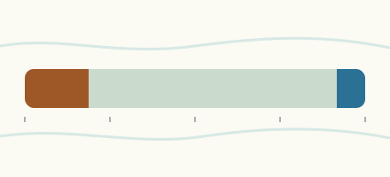 Country, Canada Are the rivers and lakes in Canada unusually low or high? Every river and lake we follow in Canada, against normal for the date.
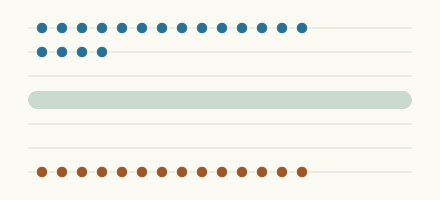 Today's list, Canada Which places in Canada are furthest from normal today? The places in Canada furthest below and above normal today.
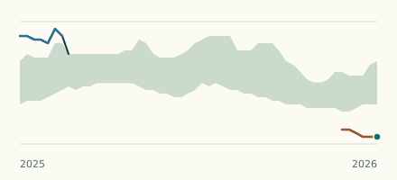 River gauge, Canada Is the Shell River unusually low at Inglis? Level now, history, the same date in past years and each year's range.
 River gauge, Canada Is the La Salle River unusually low at Elie? Level now, history, the same date in past years and each year's range.
Sources
- Data Source: Environment and Climate Change Canada (Water Survey of Canada) (source). Licence: ECCC Data Services End-use Licence v2.1.1